Shoreline Protection on Lake Ontario
The Ontario shore of Lake Ontario combines tall bluffs, open-water waves and a lake whose outflow is regulated. This page covers bluff and bank erosion, the high-water years of 2017 and 2019, the conservation authorities along the shore, and the bluff revetment work we have published at Grimsby.
Bluff and bank erosion
On the Scarborough Bluffs, the Toronto and Region Conservation Authority describes bluffs made of silt, sand and clay that are susceptible to erosion and landslides. It lists wave action, runoff, over-steepening, precipitation, wind and freeze and thaw as the drivers.
Ontario sets the regulated area along a shoreline at the furthest of the flood hazard limit, the predicted long-term stable slope and, where a dynamic beach exists, 30 metres inland, plus a further 15 metres. On a bluff, that can put land well back from the water inside the regulated area. The provincial technical guide for Great Lakes shorelines sets a standard stable slope allowance of 3 horizontal to 1 vertical, unless a geotechnical study supports another value.
Regulated lake levels and the high-water years
Lake Ontario's outflow is regulated through the Moses-Saunders dam under Plan 2014, which is overseen by the International Lake Ontario-St. Lawrence River Board of the International Joint Commission. The plan sets limits on outflow to protect against ice, to keep navigation open and to limit flooding.
The commission records Lake Ontario peaks of 75.88 metres in 2017 and 75.92 metres in 2019, and reports significant damages and other impacts along the lake and the St. Lawrence River. It attributes the high water to wet weather and record inflows, and says regulation lowered the 2019 peak by about 35 centimetres. The United States National Oceanic and Atmospheric Administration names coastal flooding and property damage from erosion among the effects of the record highs between 2017 and 2020.
Conservation authorities along the shore
Ontario groups the conservation authorities on the Lake Ontario shore into western, central and eastern sets. They include Niagara Peninsula, Hamilton, Halton, Credit Valley, Toronto and Region, Central Lake Ontario, Ganaraska Region, Lower Trent, Quinte and Cataraqui Region. Each issues its own permits under Ontario Regulation 41/24.
Under the Conservation Authorities Act, Niagara Peninsula, Hamilton Region, Halton Region and Credit Valley amalgamate into the Western Lake Ontario Regional Conservation Authority. Toronto and Region and Central Lake Ontario amalgamate into the Central Lake Ontario Regional Conservation Authority. Cataraqui Region, Ganaraska Region, Lower Trent Region and Quinte, with Crowe Valley, Kawartha Region and Otonabee Region, amalgamate into the Eastern Lake Ontario Regional Conservation Authority. The transition date is February 1, 2027, or a later date set by regulation. Confirm which authority covers your lot at the time you apply.
The Niagara Peninsula Conservation Authority covers Niagara Region, including Grimsby. Its policy document says shoreline works are to follow accepted coastal engineering principles, must not worsen hazards on adjacent properties and must leave an access corridor for maintenance machinery. It also says a professional engineer with coastal experience may be required.
The authority also publishes a Lake Ontario Shoreline Management Plan, and its policy says works should be located above the 80th-percentile high water mark, which it sets at 75.32 metres on Lake Ontario.
Beyond the authority, a new erosion control structure on shore lands may need a Ministry of Natural Resources work permit, and the Fisheries Act applies to work that affects fish habitat. In-water work has to avoid fish spawning times, and no single date applies to the whole shore: the ministry sets the window by species and region, and the permit conditions confirm it. See Shoreline permits in Ontario: who approves what.
Our Grimsby bluff revetments
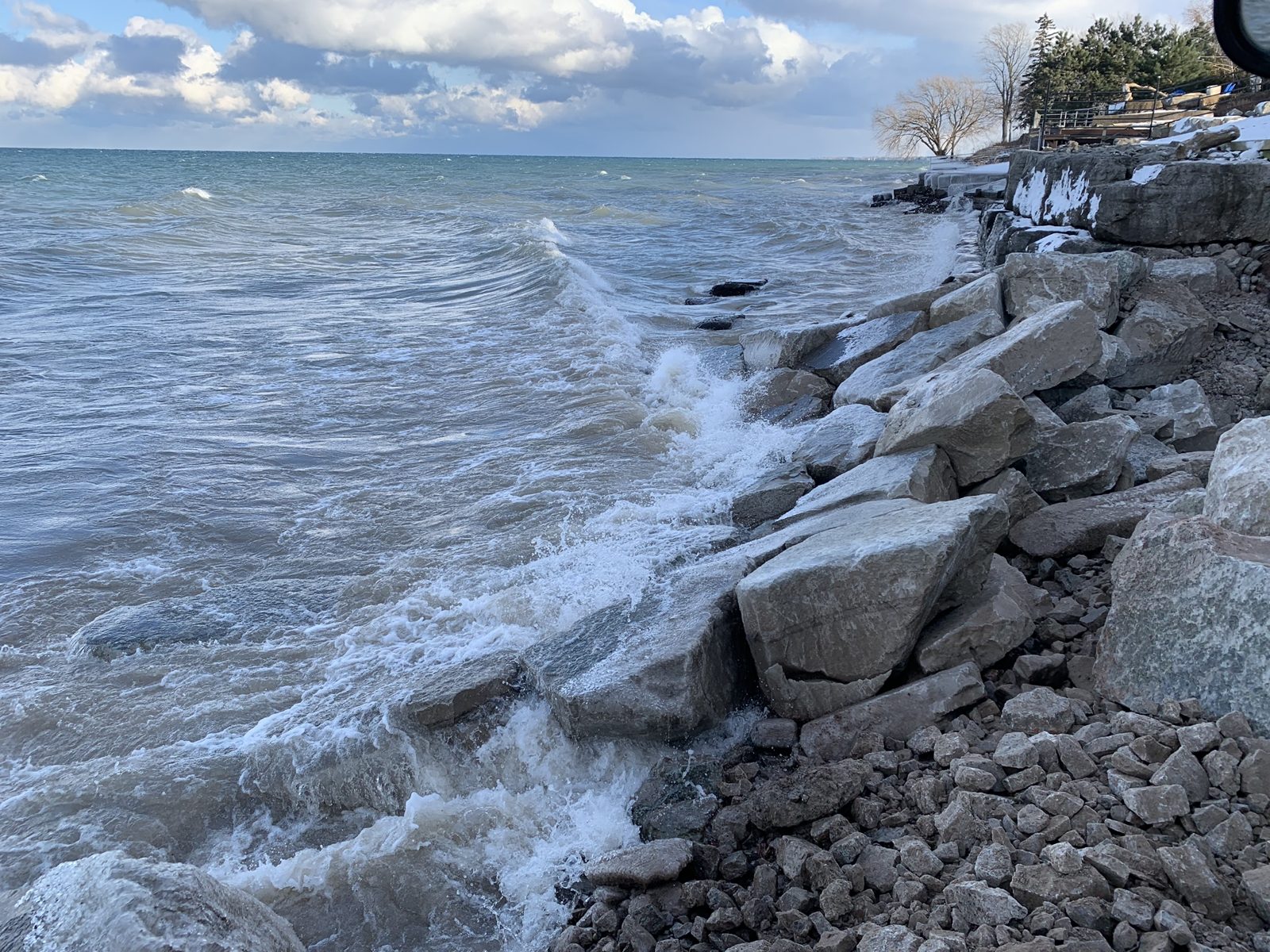
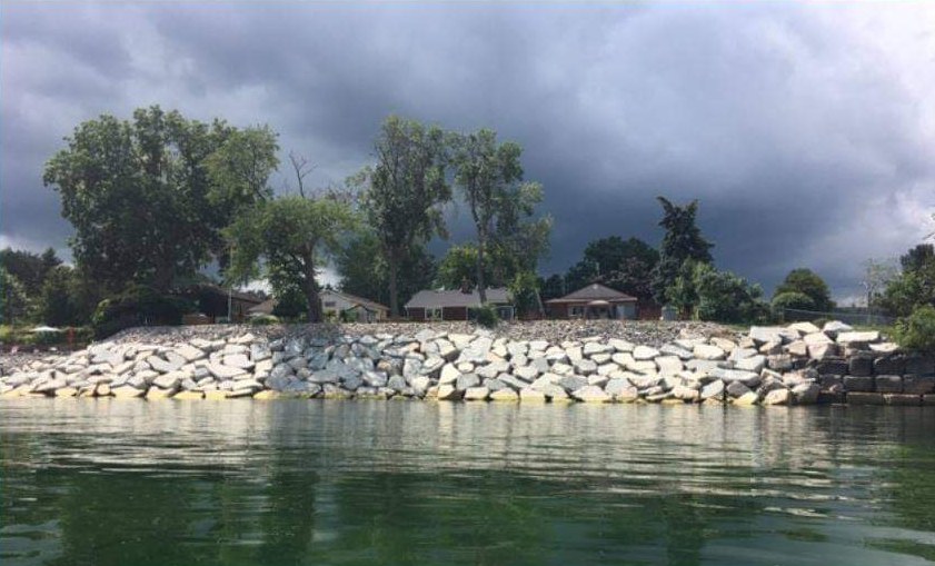
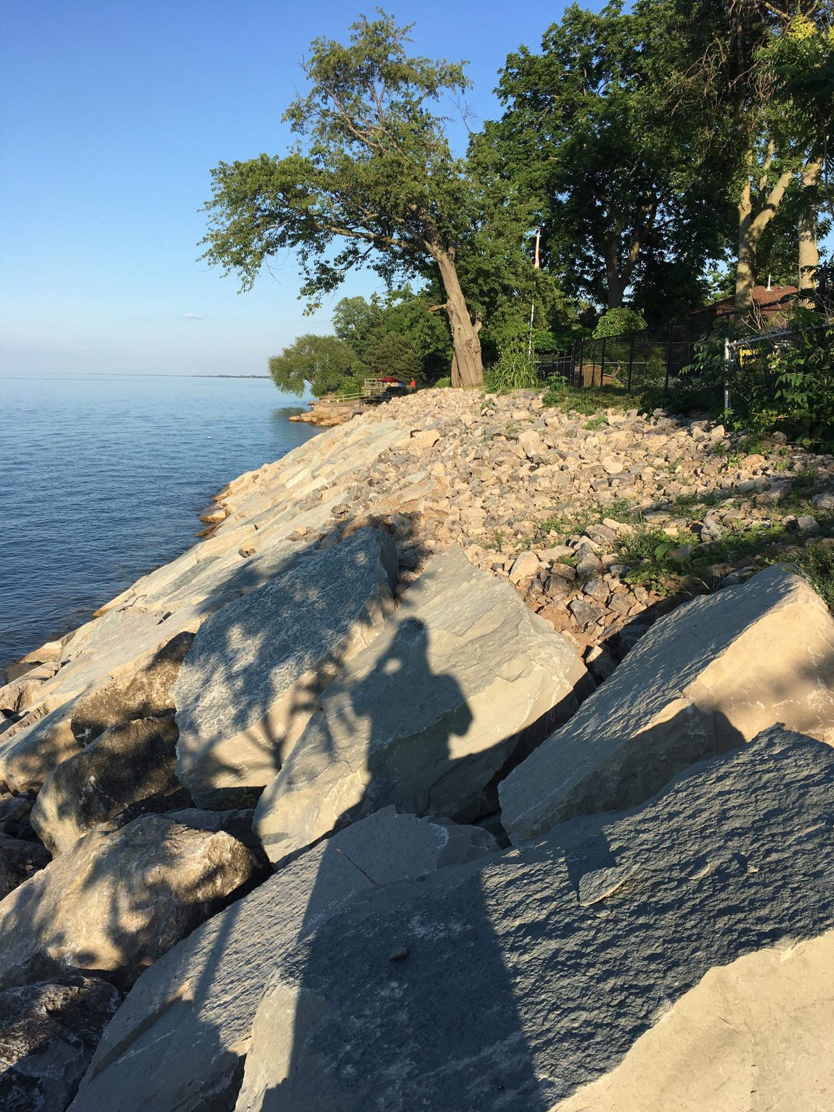
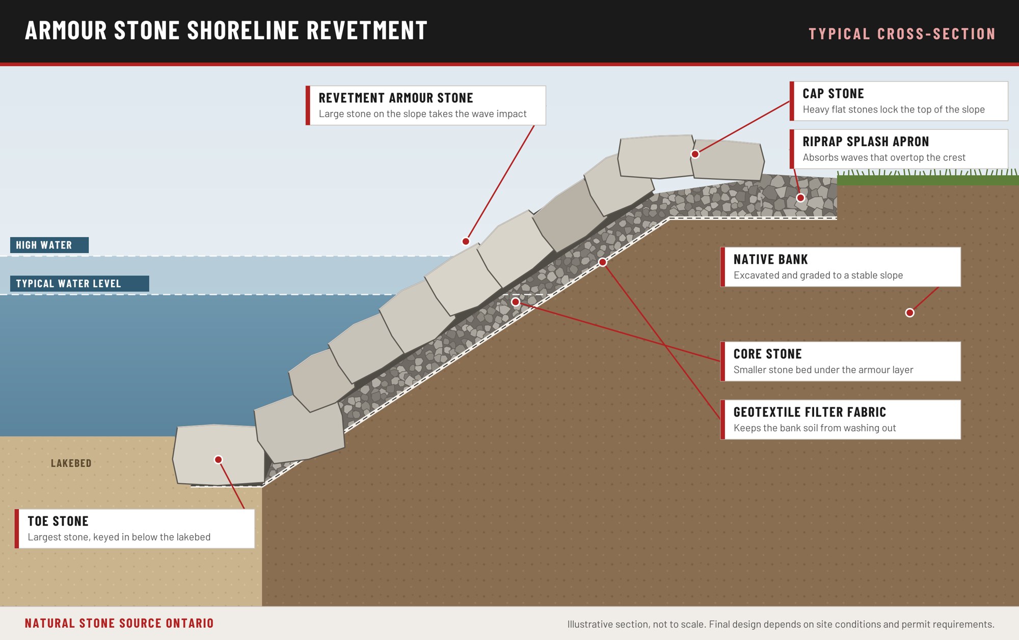
Our published Lake Ontario work is a series of bluff revetments at Grimsby, averaging roughly 30 feet in height. Each section was excavated and graded to a 3 to 1 slope, lined with filter fabric, bedded on core stone, anchored with toe stone keyed below the lakebed, and faced with large armour stone built to take the full force of open-water waves.
More photographs are on Shoreline projects.
How the layers work
The drawing below shows the layers in the order they go in. The toe stone is set first, below the lakebed, because a revetment fails from the bottom. The height of the bank and the wave exposure set the stone size and the slope.
What shoreline work costs
Shoreline work typically runs from about $500 to $20,000 per linear foot, depending on the scope of work, the height of the bank, the size of the lake and the wave exposure the site takes. Permit fees are extra. Every project is quoted after a site visit.
Questions about Lake Ontario shorelines
Does the conservation authority decide how far back from a bluff I can build?
The conservation authority maps the erosion hazard and regulates work within it. The Niagara Peninsula Conservation Authority describes the erosion hazard as the stable slope allowance plus an erosion allowance based on 100 years of recession, which can be reduced by the remaining functional life of existing shore protection. Technical studies by a coastal or geotechnical engineer may be required.
Did the high water of 2017 and 2019 come from how the lake is regulated?
The International Joint Commission attributes the high water to wet weather and record inflows, and says regulation reduced the 2019 peak by about 35 centimetres.
Will I need an engineer?
It depends on the project. The Niagara Peninsula Conservation Authority says works may be required to be designed and supervised by a professional engineer with coastal experience. The word is may, not always. The authority tells you what it needs.
Planning shoreline work? Call 1-855-787-8663 or Request a Quote.
What to send us: photos of the shoreline, the approximate length in feet, the lake and the township.