Shoreline Protection on Lake Erie
Lake Erie is the shallowest of the Great Lakes, and its shoreline takes more punishment for it. This page covers why Erie is so hard on shorelines, the record high water of 2019, the conservation authorities along the shore, and the scale of the Lake Erie project we have published.
Why Lake Erie is hard on shorelines
Canada.ca describes Lake Erie as the shallowest of the Great Lakes, with an average depth of only 19 metres. Its western basin averages 7.4 metres.
The International Joint Commission says each Great Lake typically sees one to two intense seiches a year, and that Erie, as the shallowest, tends to see the most. A seiche happens when weather pushes water to one end of a lake and it then sloshes back, and one end of a lake can flood while the other stays dry.
High water adds to it. The commission reports that Lake Erie exceeded its historical records starting in early May 2019 and that records continued through the summer. Ontario's independent review of the 2019 floods puts Lake Erie about 84 centimetres above its long-term monthly average and 13 centimetres above the previous highs of 1986, and states that flooding and erosion along the Erie shoreline had significant impacts on residents, businesses and infrastructure.
What the 2019 high water did on Erie
The same review records local detail. In Chatham-Kent, three road sections closed, totalling 9.6 kilometres. Residents between Point Pelee and Wheatley had 10 flood events between March and August 2019. Those figures describe what the lake itself did to a developed shoreline in one year.
Conservation authorities along the shore
Ontario groups Essex Region, Lower Thames Valley, Kettle Creek, Catfish Creek, Long Point Region and Grand River among the Lake Erie conservation authorities. The Niagara Peninsula Conservation Authority also administers a Lake Erie shoreline. Each issues its own permits under Ontario Regulation 41/24.
Under the Conservation Authorities Act, Catfish Creek, Grand River, Kettle Creek and Long Point Region amalgamate into the Eastern Lake Erie Regional Conservation Authority. Essex Region and Lower Thames Valley, with St. Clair Region and Upper Thames River, amalgamate into the Western Lake Erie Regional Conservation Authority. Niagara Peninsula amalgamates into the Western Lake Ontario Regional Conservation Authority. The transition date is February 1, 2027, or a later date set by regulation. Confirm which authority covers your lot at the time you apply.
Haldimand County reports that the Grand River Conservation Authority, with Long Point Region and Niagara Peninsula, updated the flood, erosion and dynamic beach hazard mapping for the county's Lake Erie shoreline to current standards. The work was completed in 2020. That mapping is what the authorities use when they review a shoreline permit application.
The Niagara Peninsula Conservation Authority publishes a Lake Erie Shoreline Management Plan update, and its policy says works should be located above the 80th-percentile high water mark, which it sets at 174.62 metres on Lake Erie. It may require shoreline works to be designed and supervised by a professional engineer with coastal experience.
A new erosion control structure on shore lands may also need a Ministry of Natural Resources work permit, and the Fisheries Act applies where work affects fish habitat. In-water work has to avoid fish spawning times, and the ministry sets the window by species and region, so no single date applies to the whole Erie shore. See Shoreline permits in Ontario: who approves what.
Before you plan an Erie shoreline
- Confirm which conservation authority covers the lot, and ask whether the lot sits in its regulated area.
- Ask the Ministry of Natural Resources whether a work permit applies to the shore lands in front of the property.
- Ask the municipality for its site alteration and zoning rules.
- Photograph the shoreline and measure its length in feet before the first call.
Our Lake Erie project
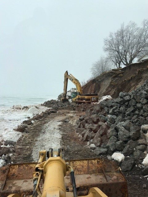
Our published Lake Erie work is a large-scale shoreline armour stone project: approximately 175 tractor-trailer loads of stone, including about 7,500 tons of armour stone, 20,000 tons of large riprap and 30,000 tons of gabion stone. It is described on Shoreline projects.
How the layers work
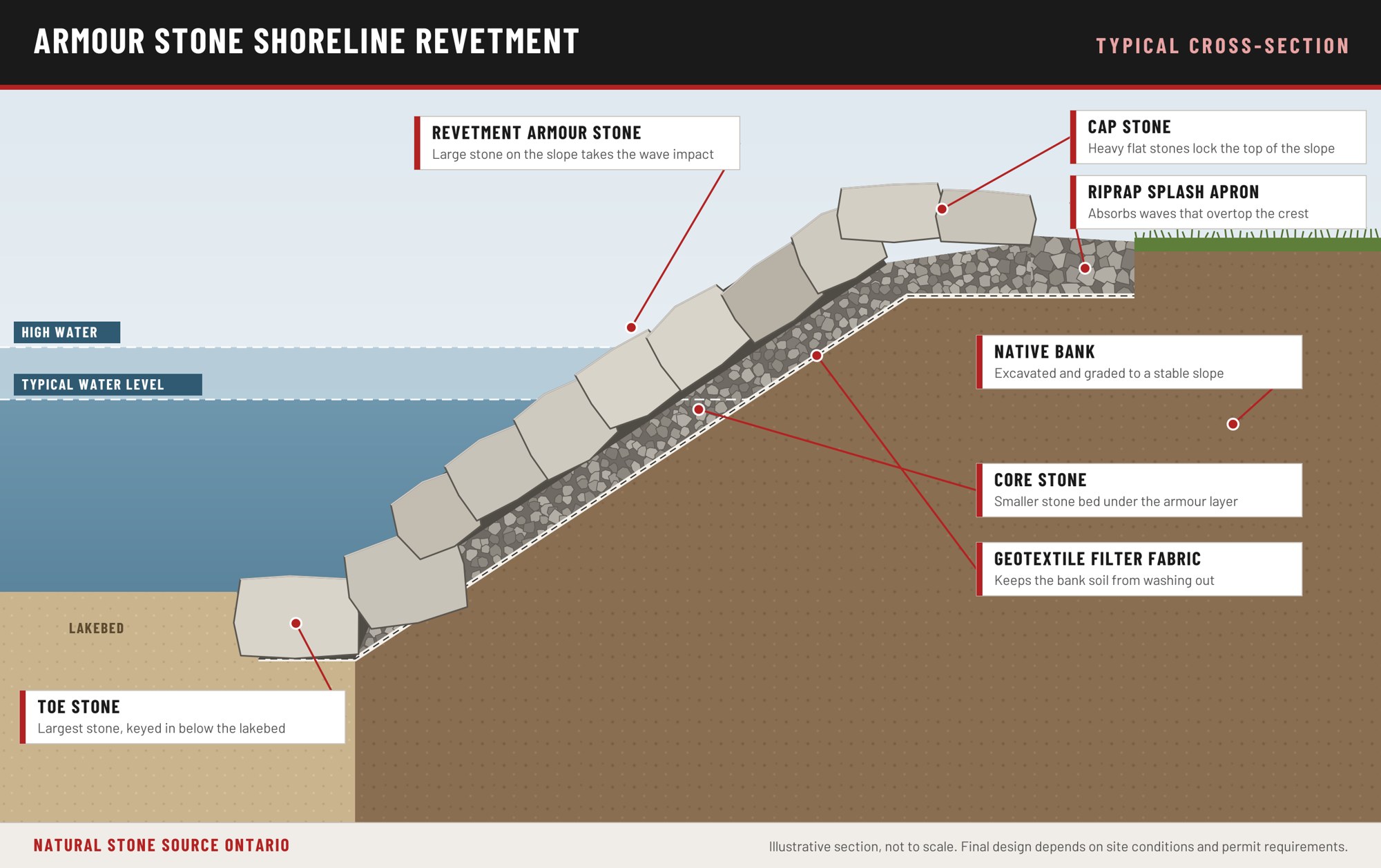
A revetment goes in from the bottom up. The toe stone is set first, below the lakebed, because a revetment fails from the bottom. Filter fabric and core stone follow, then the armour layer that takes the wave impact, and cap stone locks the top of the slope. A project on an exposed lake is sized to the exposure, which is why every project is quoted after a site visit.
What shoreline work costs
Shoreline work typically runs from about $500 to $20,000 per linear foot, depending on the scope of work, the height of the bank, the size of the lake and the wave exposure the site takes. Permit fees are extra. Every project is quoted after a site visit.
Questions about Lake Erie shorelines
Which conservation authorities are on the Lake Erie shore?
Ontario groups Essex Region, Lower Thames Valley, Kettle Creek, Catfish Creek, Long Point Region and Grand River as Lake Erie authorities, and the Niagara Peninsula Conservation Authority also has a Lake Erie shoreline. Haldimand County's hazard study was led by the Grand River authority with Long Point Region and Niagara Peninsula.
Has the Lake Erie hazard mapping been updated?
Yes. Haldimand County reports that updated flood, erosion and dynamic beach hazard mapping for its Lake Erie shoreline was completed in 2020, and that consistent mapping is critical to land use planning and permit decisions.
Do you publish the scale of your Lake Erie work?
Yes. The project involved approximately 175 tractor-trailer loads of stone, including about 7,500 tons of armour stone, 20,000 tons of large riprap and 30,000 tons of gabion stone.
Planning shoreline work? Call 1-855-787-8663 or Request a Quote.
What to send us: photos of the shoreline, the approximate length in feet, the lake and the township.